- Home
- Jyotirlinga Tours
It is a widely known fact that Lord Shiva had manifested himself in the form of a Shiva Linga during the night of Aridra Nakshatra.
Read More - Spiritual Tours
- Travel Guide
- Contact us
- Enquiry Now

It is a widely known fact that Lord Shiva had manifested himself in the form of a Shiva Linga during the night of Aridra Nakshatra.
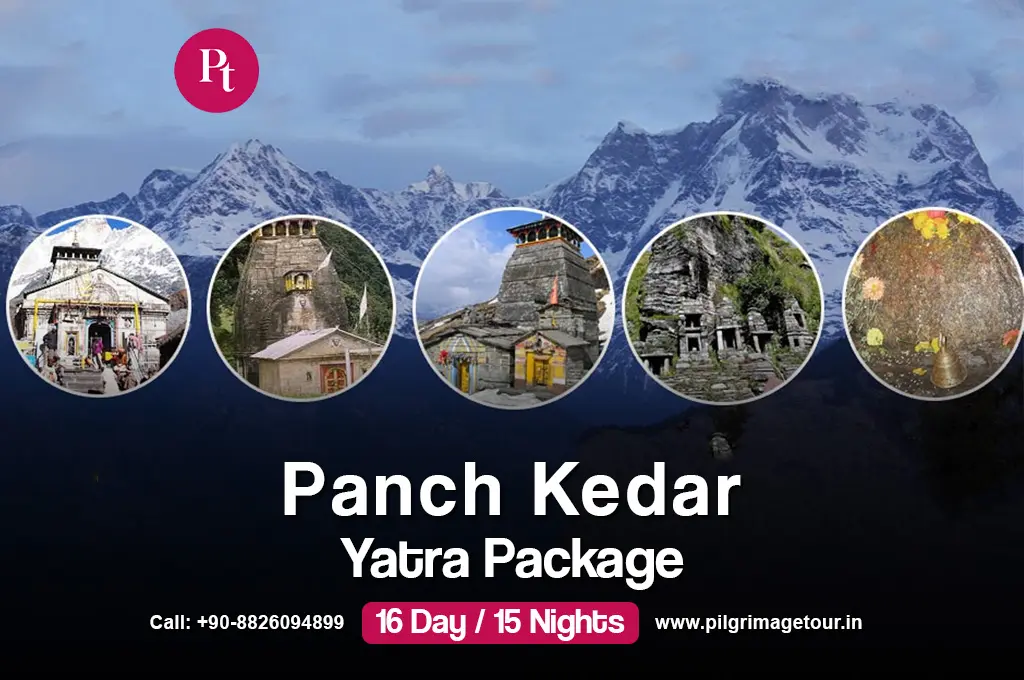
Read MoreThe Panch Kedar Pilgrimage Tour covers the 5 holiest Lord Shiva shrines spread across a ~170 km route in the Garhwal Himalayan region of Uttarakhand. The five shrines are Kedarnath, Tungnath, Rudranath, Madhyamaheshwar, and Kalpeshwar — all situated in the valley between the Alaknanda and Bhagirathi rivers. This is not a leisurely tour. Most of the journey is completed on foot, through dense forests, remote alpine meadows, and steep mountain terrain — making it one of the most physically demanding pilgrimage circuits in India.
According to Hindu mythology, after the Kurukshetra war, the Pandavas sought Lord Shiva to atone for their sins. Shiva, unwilling to meet them, disguised himself as a bull and dove into the earth at Kedarnath. His body resurfaced at five different locations: the hump at Kedarnath, the navel at Madhyamaheshwar, the arms at Tungnath, the face at Rudranath, and the matted locks (jata) at Kalpeshwar. Together, these five sacred sites form the Panch Kedar. Embarking on this Yatra is believed to bestow spiritual merit equivalent to a lifetime of pilgrimage.
| Details | Information |
|---|---|
| Tour Name | Panch Kedar Yatra Tour Package |
| Duration | 15 Days / 14 Nights |
| Start & End Point | Delhi |
| Trek Distance | ~170 km total (spread across multiple treks) |
| Maximum Altitude | ~3,680 m / 12,073 ft (Tungnath) |
| Trek Difficulty | Difficult — requires good fitness, long trekking days (10–17 km/day) |
| Destinations Covered | Delhi → Haridwar → Rudraprayag → Gaurikund → Kedarnath → Guptkashi → Gaundhar → Madhyamaheshwar → Ukhimath → Chopta → Tungnath → Sagar → Panar Bugyal → Rudranath → Urgam → Kalpeshwar → Rudraprayag → Rishikesh → Delhi |
| Package Price | ₹45,500 per person (original ₹50,000) |
| Best Season | May–June and September–October |
| Kalpeshwar Status | Open throughout the year |
| Other Temples | Open April/May to October/November 2026 |
| Temple | Opening Date 2026 | Closing Date 2026 | Winter Abode |
|---|---|---|---|
| Kedarnath Dham | 22 April 2026 | 11 November 2026 | Omkareshwar Temple, Ukhimath |
| Tungnath Temple | 22 April 2026 | 4 November 2026 (tentative) | Makkumath |
| Rudranath Temple | 18 May 2026 | 8 November 2026 (tentative) | Gopeshwar |
| Madhyamaheshwar Temple | 21 May 2026 | 20 November 2026 (tentative) | Ukhimath |
| Kalpeshwar Temple | Open throughout the year | Open throughout the year | — |
Note: Opening and closing dates are announced by the temple committees each year based on astrological calculations. Dates above are confirmed/approximate for 2026. Always verify from the BKTC (Badrinath-Kedarnath Temple Committee) website before finalising your travel dates.
Kedarnath is the most prominent of the five shrines and the starting point of the traditional Panch Kedar sequence. It is one of the 12 Jyotirlingas and part of the Chota Chardham Yatra circuit. The 16–17 km trek from Gaurikund climbs steeply through the Mandakini valley to the stone temple that has withstood Himalayan winters for over 1,200 years. The conical rock formation inside the temple represents the bull's hump — the form in which Lord Shiva disappeared into the earth. Morning and evening aartis here are deeply moving experiences.
Madhyamaheshwar is the second Kedar and arguably the most scenic — the temple sits in a meadow surrounded by some of the most beautiful Himalayan peaks visible from any pilgrimage site. The trek starts from Ransi Village (~24 km round trip) and passes through Gaundhar and Bantoli, with views of Nanda Devi, Kedarnath, Chaukhamba, and Neelkanth peaks. According to legend, Lord Shiva's middle portion (navel) appeared here. The Budha Madmaheshwar peak nearby offers a spectacular sunrise view for those who want an early morning side-trip.
Tungnath is the highest Shiva temple in the world at 3,680 metres. The 4–5 km trek from Chopta is relatively short but steep, with a well-paved pilgrim trail. The surrounding bugyals (alpine meadows) and views of Nanda Devi, Trishul, and Chaukhamba peaks make this one of the most photogenic stops on the circuit. Chandrashila peak, 1.5 km beyond Tungnath, offers a 360-degree Himalayan panorama and is worth the extra hour if you have time. The road to Chopta via Deoria Tal is considered one of the most scenic drives in Uttarakhand.
Rudranath is the most remote and least visited of the five Kedars — and because of that, the most peaceful. The trek from Sagar Village via Panar Bugyal takes 2–3 days, passing through dense forests, alpine meadows carpeted with wildflowers (especially September–October), and views of the Nanda Devi, Trishul, and Nanda Ghunti peaks. The face of Lord Shiva (Rudra) is enshrined here. An optional visit to Anusuya Devi Temple via the Naola Pass route adds mythological depth to this leg of the journey.
Kalpeshwar is the last Kedar and the only one accessible year-round. The temple is reached via a 2 km easy trek from Urgam Village in the Urgam Valley near Helang. Unlike the other four Kedars, Kalpeshwar has a cave entrance — pilgrims bend slightly to enter the natural rock cave where the Jata (matted hair) of Lord Shiva is venerated. The Kalpganga River flows alongside the trail. A short detour to Dhyan Badri Temple (150 metres off the main trail near Lyari) is worth making — it is an ancient, rarely visited shrine.
| Season | Months | Conditions | Recommended? |
|---|---|---|---|
| Spring / Summer | May – June | Temples just opened, snow still on higher trails (adds charm). Clear weather, pleasant 10–20°C at lower camps. | ✅ Yes — Most Popular |
| Monsoon | July – August | Heavy rain, leech-prone trails, poor visibility, landslide risk on approach roads. | ⚠️ Only for experienced trekkers |
| Post-Monsoon / Autumn | September – October | Crystal-clear skies, wildflowers in bloom (Panar Bugyal), best mountain views. Temples still open. | ✅ Best — Highly Recommended |
| Winter | November onwards | All temples except Kalpeshwar close. Routes snowbound. Not recommended. | ❌ Avoid (except Kalpeshwar) |
Kalpeshwar is open throughout the year — it can be visited even in winter as a standalone day trip from Joshimath or Helang. For the full Panch Kedar circuit, May–June and September–October are ideal windows.
While there is no rigid dress code, pilgrims are advised to dress modestly. Cold-weather clothing is essential — pack thermals and a windproof jacket even during summer months at high altitude.
The Panch Kedar is rated Difficult — this is not a tour for people who don't exercise regularly. The cumulative trekking distance across the circuit is approximately 128–170 km over 15 days, with daily treks ranging from 8 to 22 km and altitudes reaching 3,680 metres.
Kedarnath (3,583 m), Madhyamaheshwar (3,497 m), Tungnath (3,680 m), and Rudranath (2,286 m) all present varying altitude challenges. Common symptoms include headache, nausea, and breathlessness. Do not push through worsening symptoms — descend immediately. Consult your doctor about Diamox (acetazolamide) before the trip if you have had altitude issues before.
| Category | What to Carry |
|---|---|
| Clothing | 2–3 thermals (top + bottom), 2–3 fleece jackets, 1 windproof waterproof jacket, 2–3 trek pants, 5–6 cotton T-shirts, woolen cap, gloves, light shawl/stole for temple visits |
| Footwear | Sturdy high-ankle trekking shoes with grip (broken in before the trip), 2–3 pairs woollen socks + 3–4 cotton socks, sandals/slippers for camp use |
| Trekking Gear | 5–7 kg backpack, walking/trekking pole (highly recommended for Rudranath and Kedarnath descents), headlamp + extra batteries, rain cover for backpack, rain poncho |
| Documents | Aadhaar/Passport (original), Kedarnath Yatra registration pass (from registrationandtouristcare.uk.gov.in), emergency contact card |
| Medicines | Doctor-prescribed medicines, paracetamol, Diamox (if advised), antacid, ORS packets, antiseptic cream and bandage, moleskin for blisters, antihistamine |
| Essentials | Reusable water bottle (1 litre, carry 2 litres on Rudranath day), power bank, sunscreen SPF 50+, lip balm, UV sunglasses, personal hygiene items |
| Puja Items | Small thali, flowers (marigold), incense sticks, coconut — most available near temple shops but quality varies |
| Trek Segment | Distance (one way) | Altitude | Difficulty | Key Features |
|---|---|---|---|---|
| Gaurikund → Kedarnath | 16–17 km | 3,583 m | Difficult | Steep, well-paved trail, most visited Kedar, 12 Jyotirlinga |
| Ransi → Gaundhar → Madhyamaheshwar | ~20 km | 3,497 m | Difficult | Lush meadows, Himalayan peaks visible, passes through Bantoli |
| Chopta → Tungnath | 4 km | 3,680 m | Moderate-Difficult | Highest Shiva temple in the world, Chandrashila peak side-trip |
| Sagar → Panar Bugyal → Rudranath | 18 km total | 2,286 m | Difficult | Most remote Kedar, Panar meadows, wildflowers Sep–Oct |
| Urgam → Kalpeshwar | 2 km | 2,200 m | Easy | Cave temple, natural rock entrance, open year-round |
| Jagasu → Helang (exit) | 9 km | ~1,000 m | Easy-Moderate | Return trek post Kalpeshwar |
 10+ Places You’ll See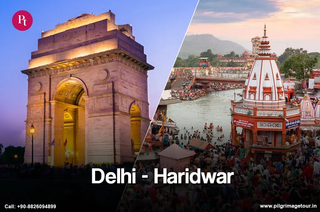

Panch Kedar Tour Package

15 Days / 14 Nights

All Meals

Private AC Vehicle

Delhi
Delhi
Rishikesh • Rudraprayag • Gaurikund • Kedarnath • Guptakashi • Gaundhar • Madhyamaheshwar • Gaundhar • Ukhimath • Chopta • Tungnath • Panargufa • Rudranath • Dumuk • Kalpeshwar
On arrival at Delhi airport or railway station, our representative receives you and drives you to Haridwar — the gateway to the Himalayan pilgrimage circuit. On reaching, check in to the hotel. In the evening, proceed for a short sightseeing tour covering Mansa Devi Temple, Chandi Devi Temple, Maya Devi Temple, and Daksheswara Mahadev Temple. Later visit Har Ki Pauri for the Ganga Aarti. Back to hotel for dinner and night stay.
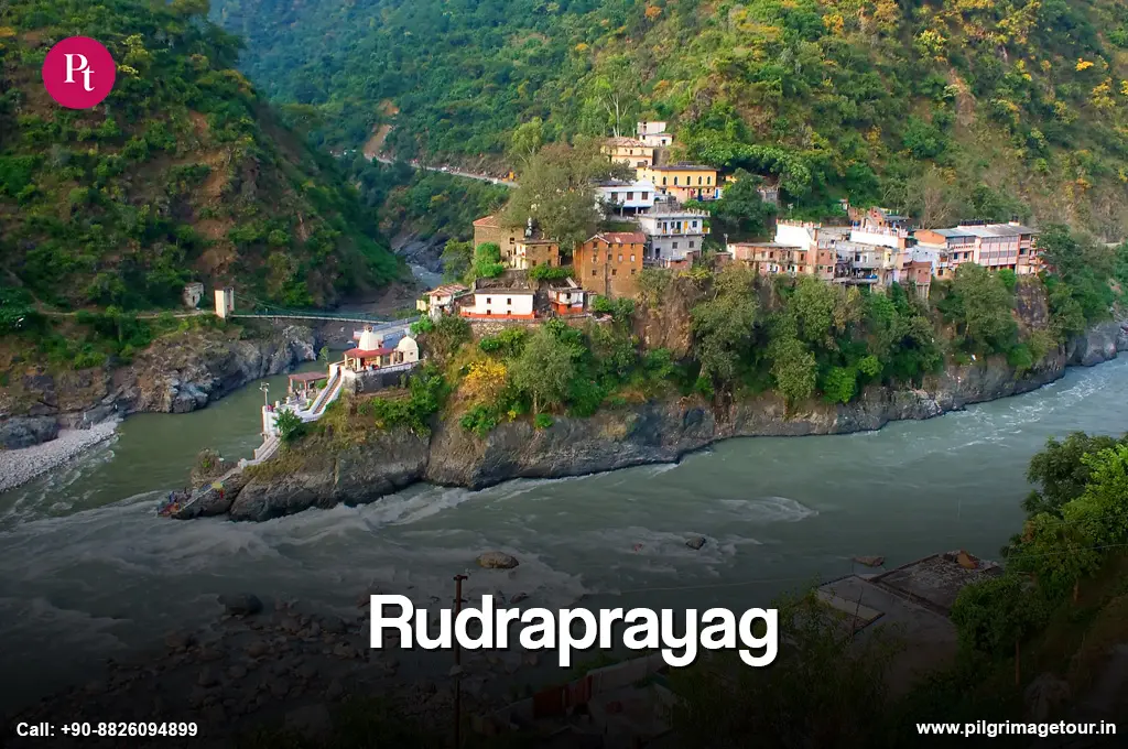
Drive to Rudraprayag via Devprayag — where the Bhagirathi and Alaknanda rivers merge to form the Ganga. This confluence is one of the most sacred spots in Uttarakhand. From Devprayag, continue to Rudraprayag and check in to the hotel. In the evening, visit the Koteshwar Mahadev Temple set in a cave on the banks of the Alaknanda. Dinner and night stay at Rudraprayag.
Drive from Rudraprayag to Gaurikund — the base camp for the Kedarnath trek. Begin the 16–17 km trek to Kedarnath Dham. The trail climbs steadily with a few level stretches. On reaching Kedarnath, check in to the guesthouse or camp and attend the evening aarti at the temple. According to legend, the conical rock formation enshrined here represents the hump of Lord Shiva in bull form. Dinner and night stay at Kedarnath.
Wake up early for morning aarti at the Kedarnath shrine. After darshan, trek back to Gaurikund and drive to Guptkashi — the place where Lord Shiva is believed to have concealed himself from the Pandavas. Guptkashi is also known as the 'hidden Kashi', with an atmosphere similar to the sacred city of Varanasi. Check in to the hotel for dinner and overnight stay.
After breakfast, drive to Ransi Village (the correct trailhead for Madhyamaheshwar), and begin the 17 km trek to Gaundhar. The trail passes through forests and crosses several streams. Overnight stay in camps at Gaundhar.
Resume the trek from Gaundhar through Bantoli (a scenic village at the confluence of Martyenda Ganga and Madhyamaheshwar Ganga) and continue the 17 km trek to Madhyamaheshwar. On reaching, check in to camps, freshen up, and visit the Madhyamaheshwar shrine. According to legend, Lord Shiva's navel (middle portion) appeared here. Back to camp for dinner and night stay.
Trek back from Madhyamaheshwar to Gaundhar. Check in to camps for dinner and overnight stay.
Trek 12 km to Jagasu, then drive to Ukhimath. Ukhimath is significant for two reasons — it is the place associated with the marriage of Usha (daughter of Vanasura) and Aniruddha (grandson of Lord Krishna), and it is also where the idols of Kedarnath and Madhyamaheshwar are worshipped during winter. Check in to hotel for dinner and night stay.
Drive from Ukhimath to Chopta (~45 km). From Chopta, begin the 4 km trek to Tungnath — the highest Shiva temple in the world at 3,680 metres. The arms of Lord Shiva are believed to have appeared here. After darshan, trek back to Chopta. Overnight stay in camps at Chopta.
If time permits, the additional 1.5 km trek to Chandrashila peak offers one of the finest Himalayan panoramas on the entire circuit.
Drive from Chopta to Sagar Village (~30 km). From Sagar, begin the 10 km trek to Panar Bugyal — a high-altitude meadow with views of Nanda Devi, Trishul, and Nanda Ghunti peaks. The trail passes through Pung Bugyal and Luiti Bugyal. Overnight stay at Panar camp.
Trek 8 km from Panar to Rudranath via Panch Ganga (the highest point on this trail). The face of Lord Shiva (Rudra) appeared at this spot. The views from Rudranath — Nanda Devi and Kamet peaks are clearly visible on clear days — are among the finest on the entire Panch Kedar circuit. After darshan, return to Panar Bugyal for overnight stay.
Trek back down to Sagar Village and drive to Urgam via Helang (~60 km, 2 hours). Urgam is the base for the Kalpeshwar trek in the Urgam Valley. Check in to camps for dinner and overnight stay.
Take the easy 2 km trek from Urgam to Kalpeshwar Mahadev — the only Panch Kedar accessible year-round. The temple has a natural cave entrance — pilgrims enter by bending slightly. Inside, the Jata (matted locks) of Lord Shiva are venerated. After darshan, return to Urgam and drive to Rudraprayag (~110 km).
Optional short detour to Dhyan Badri Temple near Lyari on the return walk. Dinner and overnight stay at Rudraprayag.
Drive from Rudraprayag to Rishikesh — the Yoga Capital of India. Check in to hotel. Visit Ram Jhula, Laxman Jhula, Neelkanth Mahadev Temple, Parmarth Niketan, and Vashistha Gufa. In the evening, attend the Ganga Aarti at Triveni Sangam Ghat. Back to hotel for dinner and overnight stay.
Drive from Rishikesh to Delhi. Our representative drops you at the railway station or airport. The Panch Kedar Yatra concludes — 15 days of some of the most challenging and spiritually significant trekking in the Himalayas.
Guptkashi is the place where Lord Shiva hid himself from the Pandavas after the Kurukshetra war. It is also called the 'hidden Kashi' for its association with the sacred city of Varanasi. According to legend, Lord Shiva took the form of a bull here and vanished into the earth, resurfacing at five locations across Uttarakhand — the origin of the Panch Kedar sites.
Devprayag is where the Bhagirathi and Alaknanda rivers merge to form the Ganga — one of the most sacred confluences in India. It is also a cultural hub with important temples including Dashrathshila Temple, Raghunathji Temple, Kyunkaleshwar Mahadev, and Chandrabadani Temple. A short stop here at the start of the Panch Kedar journey sets a meaningful tone for the pilgrimage.
Rishikesh is known for its pure vegetarian food. Popular items include chole bhature, aloo puri, pani puri, and traditional sweets like rabri and jalebi. Health-conscious travellers also enjoy fresh salads, fruit juices, and organic dishes. Most restaurants near Ram Jhula and Laxman Jhula are affordable and offer good quality.
Har Ki Pauri is the most iconic ghat — home to the Ganga Aarti and the revered footprint of Lord Vishnu. Mansa Devi Temple (accessible by cable car or a short trek) and Chandi Devi Temple (on Neel Parvat hill) are major Shakti shrines. Daksheswara Mahadev Temple at Kankhal, linked to the Daksha yagna legend, is also a key stop. Maya Devi Temple is one of the Ashtasiddhi peethas and one of the oldest temples in Haridwar.
The Panch Kedar are five Shiva shrines in the Garhwal Himalayas of Uttarakhand — Kedarnath (hump), Madhyamaheshwar (navel), Tungnath (arms), Rudranath (face), and Kalpeshwar (matted locks). Each represents a part of Lord Shiva's body from the mythological episode of the Pandavas' penance. Completing all five is believed to bring liberation from the cycle of rebirth. Kedarnath additionally holds the distinction of being one of the 12 Jyotirlingas.
Rudranath is considered the most difficult — the 18 km round trip from Sagar via Panar Bugyal involves very steep terrain, remote forest sections, and no reliable transport. Kedarnath comes second in difficulty due to its 16–17 km distance and sustained elevation gain. Kalpeshwar is the easiest at just 2 km from Urgam.
The total trekking distance across the full circuit is approximately 128–170 km, spread over multiple days. Individual trek segments range from 2 km (Kalpeshwar) to 17 km one way (Madhyamaheshwar). The circuit takes 15 nights/16 days including travel days from Delhi.
The Panch Kedar is rated difficult and is not recommended for senior citizens who are not regular trekkers. However, Kedarnath (with pony/doli service), Tungnath (short 4 km trek), and Kalpeshwar (2 km easy trek) are the most accessible of the five. A modified 3-Kedar tour covering these three is a more realistic option for elderly pilgrims or those with limited mobility.
Yes. Kedarnath requires online registration on the Uttarakhand government portal (registrationandtouristcare.uk.gov.in). Pilgrims are checked at Sonprayag before proceeding to Gaurikund. Other Panch Kedar shrines (Tungnath, Rudranath, Madhyamaheshwar, Kalpeshwar) do not currently require separate registration, but carry your ID proof throughout the route.
Kedarnath and Tungnath open around 22 April 2026. Rudranath opens around 18 May 2026, and Madhyamaheshwar on 21 May 2026. Kalpeshwar is open year-round. All four temples (except Kalpeshwar) close in November 2026 — Kedarnath on 11 November, others tentatively around November 4–20. Confirm exact dates on the BKTC website before planning your trip.
Need help choosing your trip or booking?
We are here for you.