
Ask anyone returning from the Adi Kailash Yatra about their most emotional moment, and the answer is almost always the same — Nabhidhang.
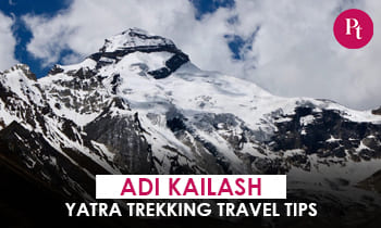
This high-altitude camp at about 4,300 metres (roughly 14,100 ft) in the Byans Valley of Pithoragarh, Uttarakhand, offers the clearest view of Om Parvat — the peak where snow settles in the shape of “ॐ”. The district administration lists it as the official Darshan point on the Kailash Mansarovar route.
And here’s what most first-timers don’t realize: no trek is needed anymore. The route is fully motorable.
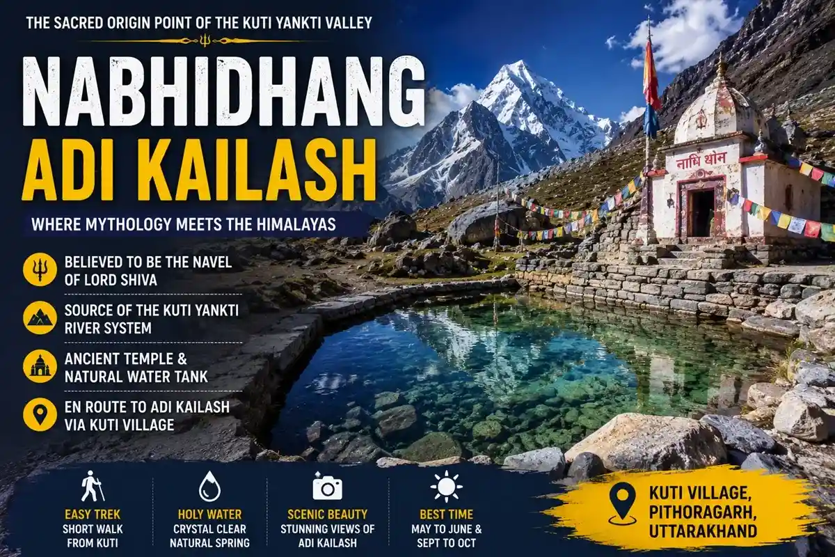
Where Is Nabhidhang?
The viewpoint sits in the Byans Valley — the last inhabited belt of Kumaon before the Indo-Tibet border, near Lipulekh Pass.
Local tradition connects the name to the “nabhi” (navel) of Goddess Parvati. Nearby landmarks — Kali Mandir at Kalapani, Vyas Gufa, Nabi and Kuti villages — are woven into the same Shiva-Parvati lore.
Om Parvat itself is listed at around 5,900 m by the district administration (published figures vary by source). From this ridge, the snow-formed ॐ appears in near-perfect alignment.
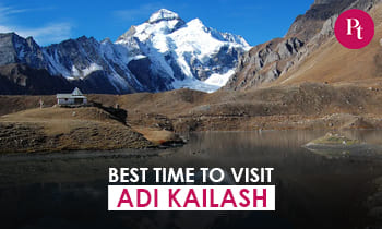
Best Time to Visit Nabhidhang
The season runs May to October. From what recent yatra groups consistently report, two windows work best:
- May–June: Residual winter snow makes the ॐ boldest and most vibrant. Peak rush — Gunji rooms fill weeks ahead.
- September–October: Post-monsoon skies stay crystal clear. Fewer crowds, colder nights.
Skip July–August. The district administration routinely suspends permits during monsoon due to landslide risk on the Dharchula–Lipulekh road — it happened again this season.
One mistake many yatris make: reaching after 10 AM. Local drivers usually recommend leaving Gunji by 5:30–6:00 AM, since afternoon clouds are almost a daily pattern here.
How to Reach Nabhidhang
- Nearest airport: Naini Saini, Pithoragarh — about 175 km from the viewpoint per district records; Pantnagar is the larger alternative.
- Nearest railheads: Kathgodam and Tanakpur, both connected to Delhi and Lucknow.
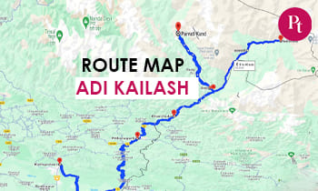
- By road: Kathgodam → Almora → Pithoragarh → Dharchula → Tawaghat → Bundi → Gunji → Kalapani → Nabhidhang.
- Helicopter option: Heli packages run from Pithoragarh — permit rules stay identical.
Beyond Tawaghat, the road turns into border terrain maintained by the Border Roads Organisation (BRO). Only 4×4 vehicles run past Gunji.
Distance Chart (Approximate — varies by road alignment)
| Stretch | Distance | Time |
| Kathgodam → Om Parvat viewpoint | ~422 km (district admin figure) | 2 days with halt |
| Kathgodam → Dharchula | ~300 km | 10–12 hrs |
| Dharchula → Gunji | ~70–100 km (varies by route) | 5–7 hrs |
| Gunji → Kalapani → viewpoint | ~25 km | 2–3 hrs |
The final stretch on foot is barely 100–200 metres uphill — manageable even for seniors who pace themselves.
Is Nabhidhang Motorable? Road Condition Explained
Yes — and this surprises many people. BRO has extended the motorable road through Kalapani right up to the darshan point, so the old multi-day trek is history.
That said, “motorable” means 4×4-only. The Nabhidhang road condition changes weekly — glacier-fed streams cross the track, and beyond Kalapani the terrain turns Ladakh-like. Small cars are not allowed past Gunji, and BRO closure notices apply during landslides.
Inner Line Permit: Step-by-Step
This is a restricted zone near the Indo-Tibet border, so an Inner Line Permit (ILP) from the SDM office, Dharchula is compulsory for Indian nationals. Foreigners face heavy restrictions here.
- Pre-register online (KMVN / Uttarakhand tourist care portal), then collect the physical ILP at SDM Dharchula. Operators handle this for package guests.
- Attach ID proof (Aadhaar/Voter ID/Passport), 2–4 photos and a medical fitness certificate.
- Pay the fee — around ₹300–400, subject to revision. Approval takes roughly 1–3 working days; timelines can change per administrative orders.
- Carry 3 physical copies plus digital backups. ITBP posts at Chialekh, Kalapani and the viewpoint verify permits.
Apply 7–10 days ahead — there’s no on-site replacement for a lost permit.
Nabhidhang Weather
Even in June, nights hover near 0°C. Daytime UV at this high altitude is intense — sunburn and snow glare catch out more first-timers than the cold does.
Mornings stay calm. Wind and cloud build after noon, almost like clockwork. Plan every darshan around that pattern.
Altitude & Health (AMS)
Above 14,000 ft, oxygen saturation drops noticeably, and Acute Mountain Sickness (AMS) — headache, nausea, breathlessness — is the biggest trip-spoiler here.
Spend a full acclimatisation day at Gunji (3,200 m), hydrate well, and descend if symptoms worsen. Operators generally follow a 9–70 years age guideline with a medical fitness certificate.
Where to Stay
There’s no overnight stay at the viewpoint itself — it’s a darshan halt. Practical bases:
- Gunji: Homestays and the KMVN guesthouse; most groups spend two nights here.
- Dharchula: Proper hotels, the last ATMs and reliable network.
- Nabi and Kuti villages: Simple Bhotiya-run homestays with warm food and warmer hosts.
Availability changes each season, so confirm before travel. Families usually choose Gunji; budget travellers do well in Nabi.
What Else to See Nearby
- Kali Mandir, Kalapani: Traditional origin of the Kali River.
- Vyas Gufa: Cave associated with sage Ved Vyas.
- Kuti village: Linked to the Pandavas; base for Adi Kailash darshan.
- Adi Kailash: Most itineraries combine both darshans in one circuit.
Budget (Indicative)
- Private packages, 6–8 days from Kathgodam: ₹25,000–50,000 per person.
- KMVN official packages: roughly ₹40,000 (ex-Dharchula) to ₹50,000 (ex-Kathgodam).
- Shared 4×4 beyond Dharchula: ₹3,000–5,000 per vehicle per day.
- Homestays: ₹800–1,500 per night with meals.
All prices are indicative and vary by operator. Booking early is recommended during the May–June rush.
Packing List
Heavy woollens, windproof jacket, UV sunglasses, SPF 50 sunscreen, sturdy shoes, personal medicines, power bank, cash from Dharchula onwards, torch, and toilet paper (campsites have dry pit toilets).
Common Mistakes to Avoid
- Skipping the acclimatisation day at Gunji.
- Starting late and finding the peak clouded over.
- Carrying only one permit copy.
- Expecting ATMs or network beyond Dharchula — BSNL works patchily near Gunji.
- Senior citizens should prefer September and consult a doctor about altitude medication.
Latest Updates (2026)
- The 2026 season opened in May, once BRO cleared winter snow from the high stretches.
- Permits remain subject to district advisories — the Pithoragarh administration suspended ILP issuance during heavy monsoon rain this season, with resumption expected around mid-September.
- Online pre-registration runs through KMVN; the physical permit is still collected at Dharchula.
Key Takeaways
- The ॐ on Om Parvat is fully legible from this ridge on clear mornings.
- Entirely motorable — only a 100–200 m walk at the end.
- ILP from SDM Dharchula is non-negotiable; go May–June or September–October, before 10 AM.
Conclusion
Nabhidhang rewards planners, not gamblers. The best option for most travellers is a 6–8 day Kathgodam circuit combining Adi Kailash with this sacred Om Parvat viewpoint, with two nights at Gunji for acclimatisation. It suits pilgrims, photographers, families — and seniors who take it slow. Lock late May or mid-September, sort the permit a week ahead, and be on that ridge by 8 AM. The mountain does the rest.
FAQs
Q-1: What is Nabhidhang famous for?
It is the closest, clearest viewpoint of Om Parvat, where snow naturally forms the sacred ॐ symbol.
Q-2: What is the Nabhidhang altitude?
About 4,300 metres (roughly 14,100 ft) in the Byans Valley of Pithoragarh, Uttarakhand.
Q-3: What is the best time to visit Nabhidhang?
May–June and September–October, ideally reaching the ridge before 10 AM.
Q-4: Is Nabhidhang motorable?
Yes. A BRO-built 4×4 track runs via Kalapani; only the last 100–200 metres is on foot.
Q-5: What is the Gunji to Nabhidhang distance?
Around 25 km one way — a 2–3 hour drive by 4×4 vehicle.
Q-6: How high is Om Parvat?
The district administration lists it at about 5,900 m; published figures vary by source.
Q-7: Is a permit needed?
Yes. An Inner Line Permit from SDM Dharchula is mandatory, verified at ITBP checkposts en route.
Q-8: How is the Nabhidhang road condition?
4×4-only border terrain with stream crossings; conditions change weekly and BRO advisories apply.
Q-9: How do I reach from Delhi?
Train to Kathgodam or Tanakpur, road to Dharchula, then 4×4 via Gunji.
Q-10: Can senior citizens visit?
Yes — no trek is involved. Acclimatise at Gunji and carry a doctor’s fitness certificate.
Q-11: What is the weather like?
Near 0°C nights even in summer, intense daytime UV, and clear mornings turning cloudy by afternoon.
Q-12: Is there mobile network or ATM?
No. Dharchula has the last ATMs and reliable network; BSNL works patchily near Gunji.
Q-13: Is Nabhidhang the same as Om Parvat?
No. Om Parvat is the peak; Nabhi Dhang is the ridge you view it from. Climbing the peak is not permitted.
Q-14: Why do permits get suspended sometimes?
The district administration pauses ILPs during monsoon landslide risk, usually resuming after mid-September.
Q-15: Can I combine Adi Kailash and Om Parvat in one trip?
Yes — nearly all itineraries cover both darshans in a single 6–8 day circuit from Dharchula.


 Call
Call WhatsApp
 Enquiry