
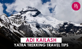
Every Adi Kailash Yatra has one moment nobody forgets — the vehicle takes a final bend, the valley opens, and the sacred peak stands ahead. That bend is Jolingkong.
This high-altitude meadow at approximately 4,380–4,570 m (figures vary by source) in the Kuthi Yankti Valley of Pithoragarh, Uttarakhand, is the last motorable point of the Yatra for pilgrims and the closest Darshan point of Adi Kailash. A glacial lake and a small Shiva-Parvati temple sit here; on still mornings, the peak’s reflection appears in the water. You’ll also see the name spelt Jyolingkong or Jollingkong — same place.
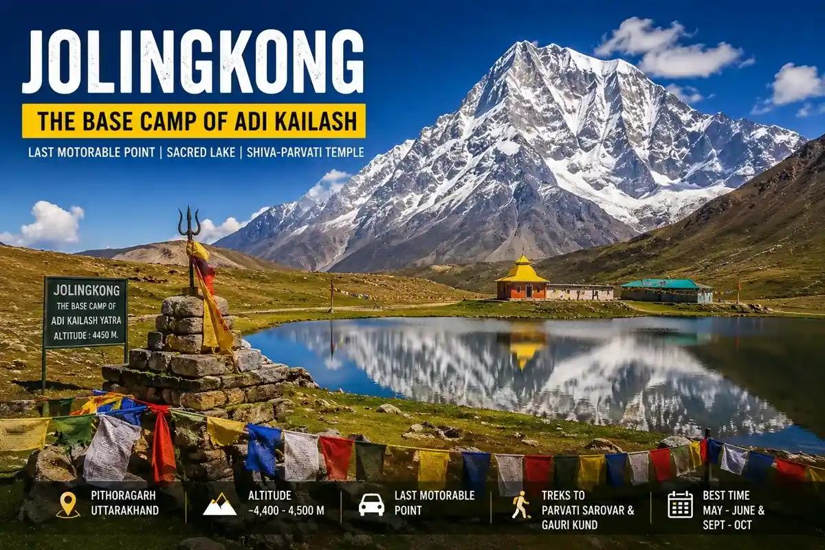
Quick Facts
| Item | Detail |
| Location | Kuthi Yankti Valley, Byans region, Pithoragarh (approx. 30.33°N, 80.41°E) |
| Altitude | ~4,380–4,570 m (KMVN 4,378 m; figures vary by source) |
| What’s here | Glacial lake, Shiva-Parvati temple, ITBP camp, Adi Kailash darshan |
| Access | 4×4 only via Dharchula–Gunji–Kuti; tourist road ends here |
| Permit | Inner Line Permit (SDM Dharchula) mandatory |
| Fuel / ATM / Network | Last petrol pump and ATMs at Dharchula; no reliable network beyond it |
| Medical | Basic aid via ITBP/army posts; nearest hospital Dharchula — carry oxygen support if advised |
| Season | May–October (winter closed; monsoon advisories apply) |
Where Is Jolingkong — and Why It Matters
The meadow sits at the head of the Kuthi Yankti Valley, past Kuti — the last village of the route, linked by local tradition to the Pandavas. The Kuthi Yankti River, a source stream of the Kali, rises from glaciers near here. Adi Kailash, commonly listed at 5,945 m and revered as one of the Panch Kailash peaks, rises directly above.
According to local belief, Lord Shiva’s wedding procession camped in this valley, and Goddess Parvati’s penance site — Gauri Kund — lies a short trek above. For pilgrims this isn’t a viewpoint; it’s the courtyard of Kailash.
A note on names: most operators call the lake Parvati Sarovar; some references extend the meadow’s own name to it, or call it Gauri Kund. Guides treat the Sarovar and the higher kund as separate darshans.
Best Time to Visit Jolingkong
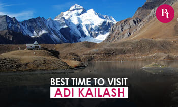
The route stays open May to October. May–June brings snow-ringed drama and the peak rush; September–October brings the clearest skies and calmest lake — best odds of the reflection. Avoid July–August: the district administration suspends permits during monsoon landslide risk, as happened again this season. Winter is closed.
Local drivers usually recommend leaving Gunji by 5:30–6:00 AM — wind ruffles the lake by late morning, and afternoon clouds swallow the summit almost daily.
How to Reach the Adi Kailash Base Camp
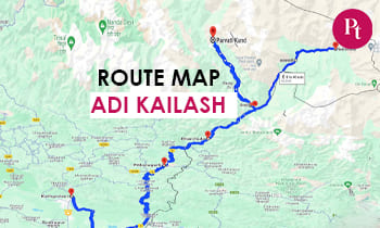
- Route: Kathgodam/Tanakpur → Pithoragarh → Dharchula → Gunji → Nabi → Kuti → the road-end meadow.
- Railheads: Kathgodam and Tanakpur; nearest airstrip Naini Saini (Pithoragarh).
- Vehicles: 4×4 only beyond Gunji on the BRO border road; streams and moraine are routine.
- Helicopter: Heli packages from Pithoragarh, with identical permit rules.
Distance Chart (Approximate — sources vary by road alignment)
| Stretch | Distance | Time |
| Dharchula → Gunji | ~70–90 km | 4–6 hrs |
| Gunji → Kuti | ~17–20 km | 1–1.5 hrs |
| Kuti → the meadow | ~14–15 km (govt/operator figures) | ~1 hr |
| Gunji → Jolingkong (total) | ~25–30 km by road, alignment dependent | 2–3 hrs |
Is Jolingkong Motorable?
Yes — right up to the meadow, and this is what changed the Yatra. The tourist road journey generally ends here: pilgrim vehicles stop, while army, ITBP and BRO vehicles continue where required. Onward movement for visitors is on foot.
Road condition changes weekly: glacier-fed streams cross the track and snow lingers into June; BRO closure notices apply during landslides.
Can Your Vehicle Reach?
- Small cars (Alto, sedans): No — not permitted beyond Gunji.
- SUVs (Innova, Scorpio, Thar): Only genuine 4x4s with local clearance; most visitors switch to registered local Boleros.
- Bikes: Experienced riders manage with permits, but stream crossings and thin air make it a hard ride — go in groups.
- Self-drive: Allowed with a valid ILP, but local drivers know the streams and diversions — hiring is the safer call.
Treks from the Base Camp
- Parvati Sarovar (~1–3 km, drop-point and trail-alignment dependent): A cemented path leads to the lake and Shiva-Parvati temple; water stays 2–6°C even in summer.
- Gauri Kund (approximately 3–4 km): Parvati’s penance pool above the Sarovar. Visitors are generally advised not to enter the sacred waters; mules cost roughly ₹2,000–4,000 (indicative).
- En route: Bheem ki Kheti near Kuti, the Parvati Mukut ridge, and Pandav Parvat.
Best photo spot: The lakeshore at sunrise, before the wind breaks the reflection.
Jolingkong vs Nabhidhang — Plan Both Days Right
| This meadow (Adi Kailash side) | Nabhidhang (Om Parvat side) | |
| Darshan | Adi Kailash peak + lake | The snow-formed ॐ |
| Walking | 1–4 km optional treks | Barely 100–200 m |
| From Gunji | Via Kuti (Kuthi Yankti Valley) | Via Kalapani (Lipulekh road) |
Standard itineraries do them on separate mornings from Gunji — don’t club both in one day.
Who Should Visit — and Who Should Skip the Treks
Ideal for: Pilgrims, photographers, fit families, and trekkers wanting the closest legal approach to Adi Kailash.
Should skip the treks (not the drive): AMS symptoms, heart/BP issues or knee trouble — the lakeside darshan at the road-end is complete in itself.
Inner Line Permit
The base camp lies in a restricted zone near the Indo-Tibet border, so an Inner Line Permit (ILP) from the SDM office, Dharchula is compulsory for Indian nationals; foreigners face heavy restrictions.
- Pre-register online (KMVN / Uttarakhand tourist care portal), then collect the physical ILP at Dharchula.
- Carry ID proof, 2–4 photos and a medical fitness certificate; a medical check is done at Dharchula.
- The fee is nominal and subject to revision; approval takes roughly 1–3 working days.
- ITBP posts verify permits en route — keep 3 copies plus digital backups. Photography is restricted near posts; drones are prohibited.
Weather, Altitude & Health
Nights hover near 0°C even in June, daytime UV is intense, and oxygen is thin above 14,000 ft — AMS is the biggest risk.
| Months | What to Expect |
| May–June | Snow patches, cold mornings, stable windows |
| July–Aug | Monsoon landslides; permits often suspended |
| Sept–Oct | Clearest skies, coldest safe window |
| Nov–April | Snowbound, route closed |
Acclimatise a full day at Gunji (3,200 m), hydrate, and descend if symptoms worsen. Basic aid is available via ITBP/army posts; the nearest hospital is at Dharchula. Operators follow a 9–70 age guideline with medical fitness. Seniors should prefer September, use mules, and treat the Sarovar as a complete darshan.
Where to Stay & Budget
Permanent accommodation is unavailable at the meadow — seasonal operator camps may exist some years; most travellers stay at Kuti or Gunji.
- Kuti: A handful of Bhotiya homestays — the closest sleep point.
- Gunji: Homestays and the KMVN guesthouse; the standard two-night acclimatisation base.
- Dharchula: Hotels, the last ATMs, fuel and reliable network.
Indicative costs: 6–8 day packages from Kathgodam ₹25,000–50,000 per person; homestays ₹800–1,500 with meals; shared 4×4 beyond Dharchula ₹3,000–5,000 per vehicle daily. Booking early is recommended for the May–June rush.
Travel Tips & Common Mistakes
- Don’t skip the Gunji acclimatisation day — AMS ruins more trips than weather.
- Start early; late means a clouded peak and a ruffled lake.
- Carry cash from Dharchula and multiple permit copies; no reliable network beyond it.
- Pack windproofs, UV sunglasses, SPF 50, sturdy shoes and personal medicines.
Latest Updates (2026)
- The 2026 season opened in May once BRO cleared winter snow, per operator and district notifications.
- News reports confirm the Pithoragarh administration paused ILP issuance during heavy monsoon rain this season, with resumption expected around mid-September — check the latest district advisory before travel.
- Figures here were cross-checked in July 2026 against KMVN and district pages; where sources differ, we show ranges.
Key Takeaways
- The meadow is the last motorable point for pilgrims and the base camp of the Adi Kailash Yatra.
- Two short treks start here: Parvati Sarovar (~1–3 km) and Gauri Kund (~3–4 km); mules available.
- ILP from SDM Dharchula is non-negotiable; go May–June or September–October, reaching by 8 AM.
- Sleep at Kuti or Gunji — permanent accommodation is unavailable on-site.
Conclusion
Jolingkong is where the road ends and the darshan begins. The best plan is the 6–8 day Kathgodam circuit with two nights at Gunji, driving up to this Adi Kailash base camp on a clear early morning, and letting fitness and weather decide between the Sarovar and the kund. It suits pilgrims, photographers and fit families; seniors manage with mules and morning starts. Lock late May or mid-September, sort the permit a week ahead — the meadow, the lake and the mountain handle the rest.
FAQs
Q-1: What is Jolingkong famous for?
It’s the base camp and last motorable point of the Adi Kailash Yatra, with a glacial lake, a Shiva-Parvati temple and the closest darshan of the peak.
Q-2: What is the Jolingkong altitude?
Approximately 4,380–4,570 m depending on the reference — KMVN lists 4,378 m, while district pages cite higher figures.
Q-3: What is the Gunji to Jolingkong distance?
Around 25–30 km by road via Kuti village, depending on the current alignment — a 2–3 hour 4×4 drive.
Q-4: Is Jolingkong motorable?
Yes, for pilgrims it’s the last motorable point — tourist vehicles stop at the meadow, while army/BRO vehicles continue where required.
Q-5: What is Jolingkong lake called?
Most operators call it Parvati Sarovar; some references extend the meadow’s name to the lake, or call it Gauri Kund.
Q-6: Do I need a permit?
Yes — an Inner Line Permit from SDM Dharchula, verified at ITBP checkposts en route.
Q-7: What is the best time to visit Jolingkong?
May–June and September–October, reaching by around 8 AM; the route closes in winter and during monsoon advisories.
Q-8: Can my own car or bike reach?
Small cars can’t go beyond Gunji; capable 4×4 SUVs and experienced bikers manage with permits, but most switch to local Boleros.
Q-9: Can I stay overnight at the meadow?
Permanent accommodation is unavailable — seasonal camps may exist some years; pilgrims base at Kuti or Gunji.
Q-10: How far are Parvati Sarovar and Gauri Kund from here?
Parvati Sarovar is roughly 1–3 km (drop-point dependent); Gauri Kund is approximately 3–4 km, with mules available.
Q-11: Is fuel, ATM or medical help available?
The last petrol pump, ATMs and hospital are at Dharchula; en route, ITBP/army posts provide basic emergency aid.
Q-12: Can I combine it with Om Parvat?
Yes — standard itineraries do this valley and Nabhidhang on separate mornings from the Gunji base.


 Call
Call WhatsApp
 Enquiry